In April 2020, ELIAMEP’s South-East Europe Programme launched a project which mapped the spread of COVID-19 in the countries of Southeast Europe, namely Albania, Bosnia and Herzegovina, Bulgaria, Croatia, Greece, Kosovo, Montenegro, North Macedonia, Romania, Serbia, Slovenia, and Turkey.
An interactive map visualized pandemic’s toll in the region (cumulative confirmed cases, cases per day, cumulative confirmed deaths, deaths per day, total persons tested, tests per day, total recoveries, recoveries per day), including also quantitative and qualitative data about each government’s emergency political and economic measures, social distancing, travel restrictions, and all other relevant decisions taken by the twelve countries of Southeast Europe.
The platform was updated daily with data and visuals from April 1st to May 31st, 2020. Through this project, we managed to generate information about the multiple effects of the crisis on health systems, the democratic institutions and civil liberties, the economies, and the geopolitics of the region. You may find some of the data collected during the project in the pictures below.
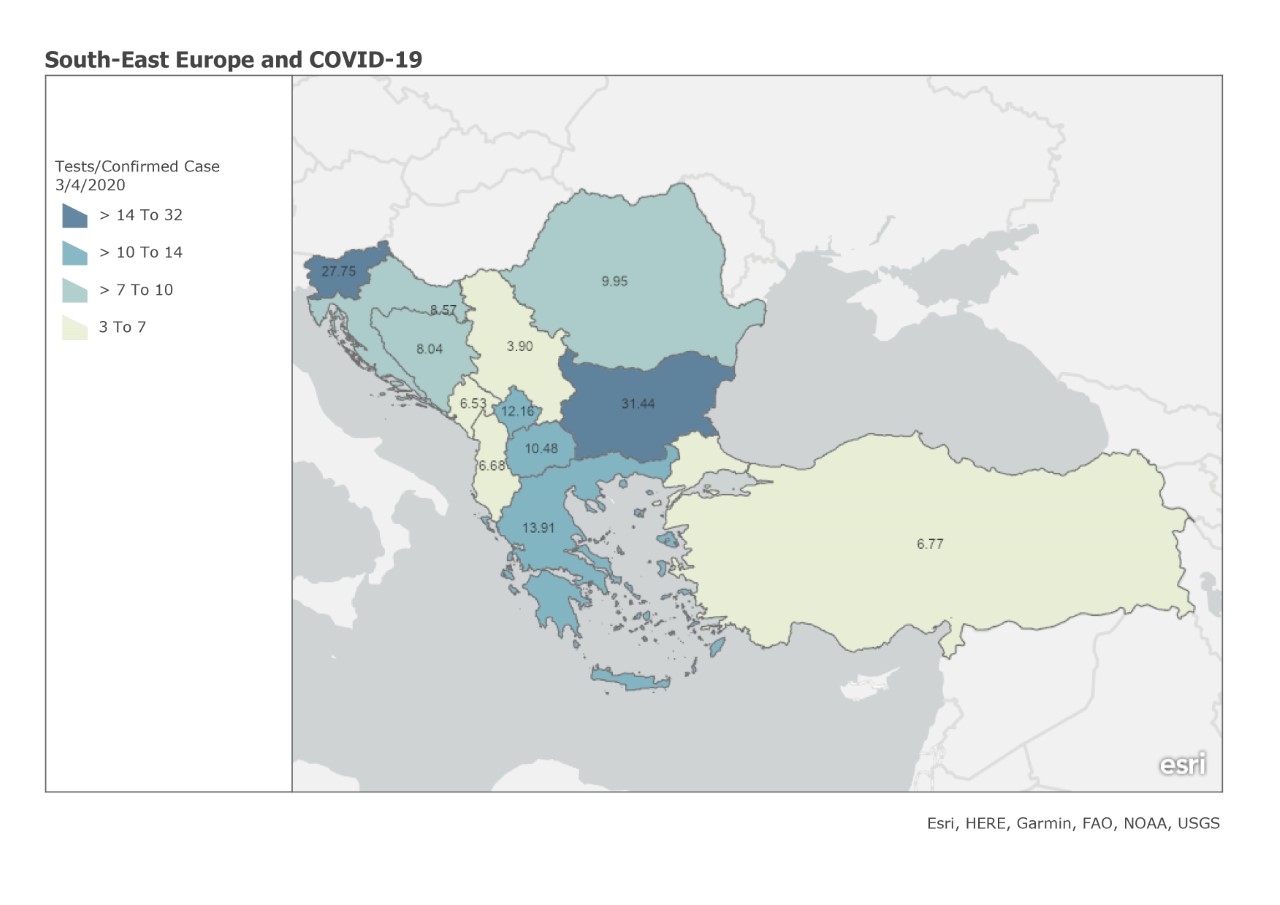 Covid-19 Confirmed Tests/Confirmed Cases in South-Eastern Europe – 3 April 2020
 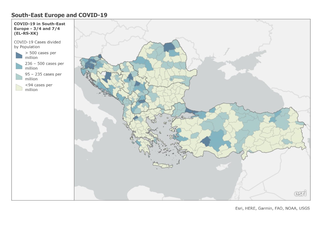 Covid-19 Cases/Population in South-Eastern Europe – 3 April 2020
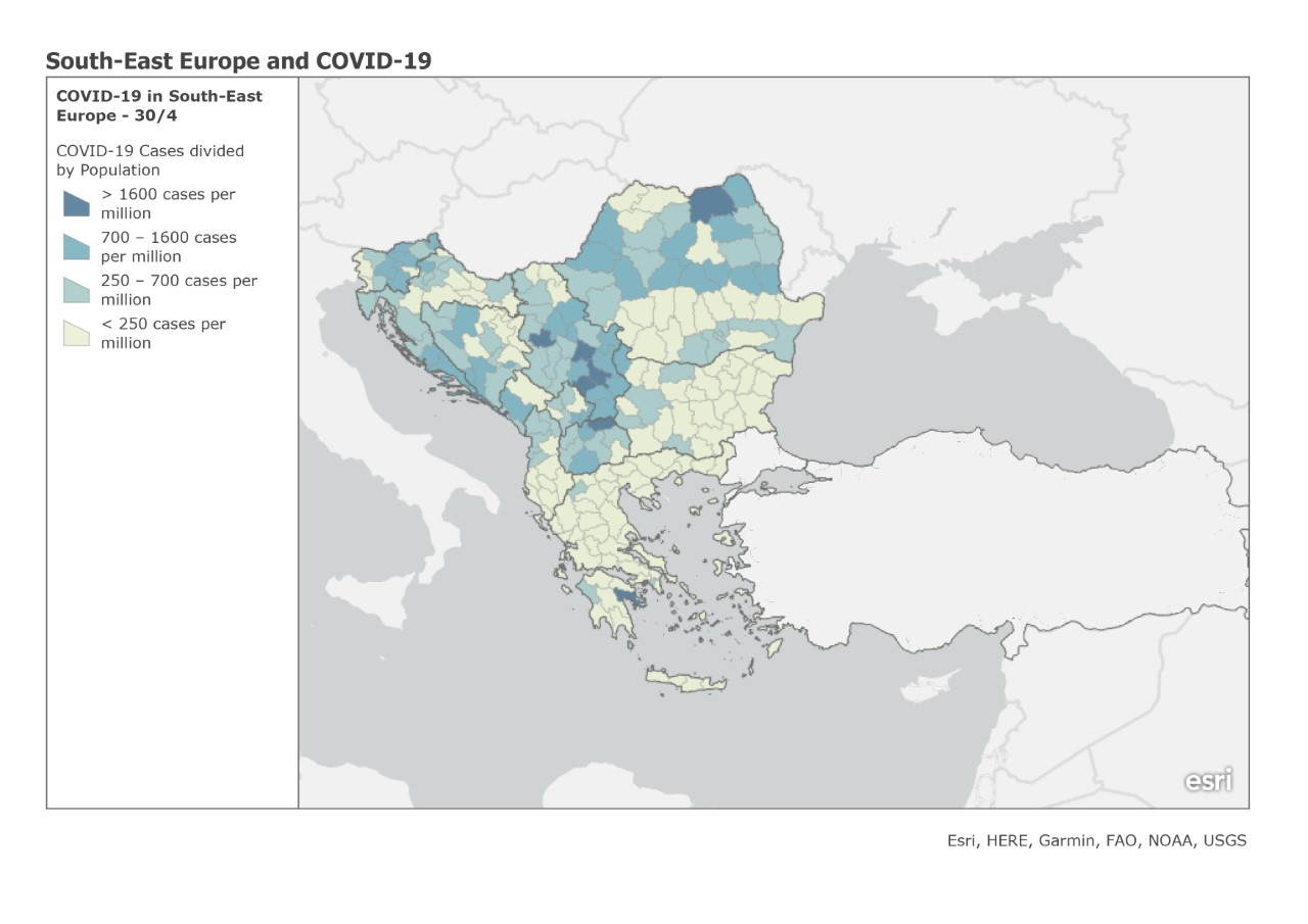 Covid-19 Cases/Population in South-Eastern Europe – 30 April 2020
 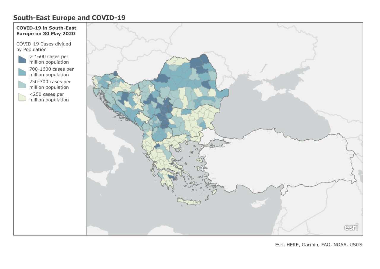 Covid-19 Cases/Population in South-Eastern Europe – 30 May 2020
 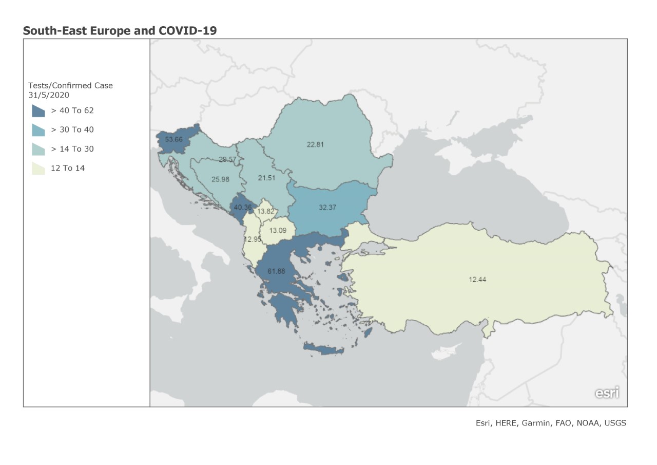 Covid-19 Confirmed Tests/Confirmed Cases in South-Eastern Europe – 31 May 2020
  Covid-19 Confirmed Deaths/Population in South-Eastern Europe – 31 May 2020
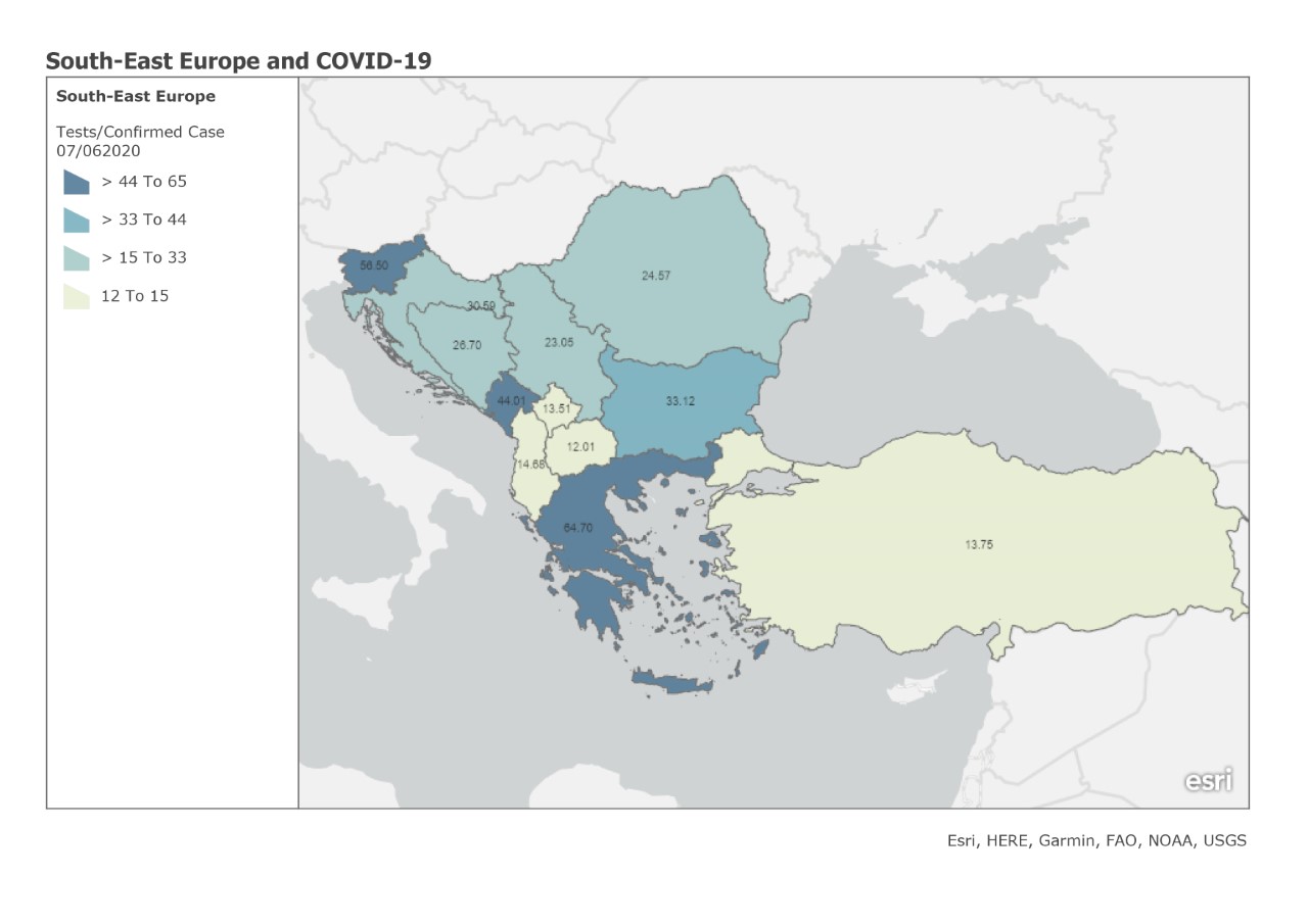 Covid-19 Confirmed Tests/Confirmed Cases in South-Eastern Europe – 7 June 2020
 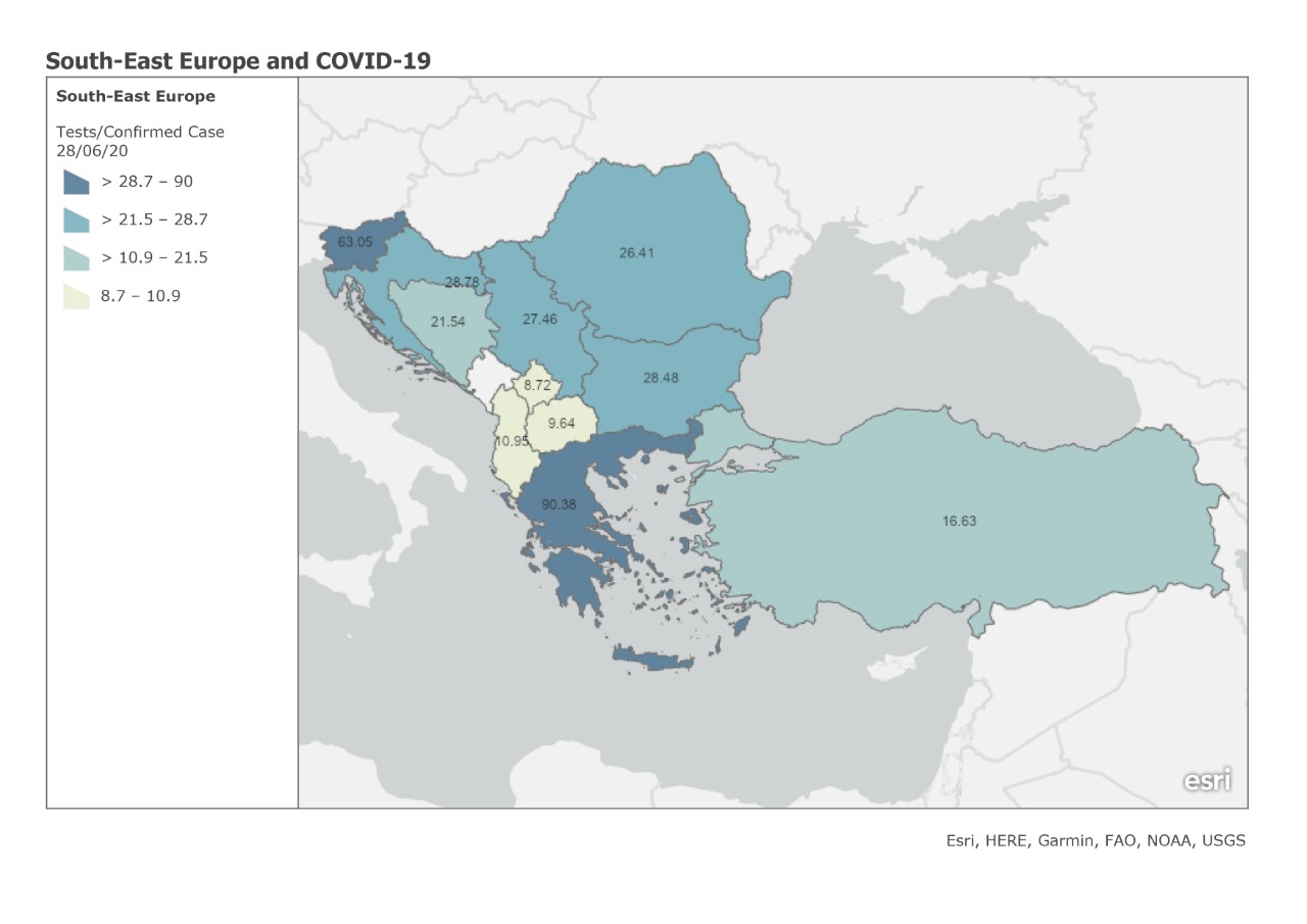 Covid-19 Confirmed Tests/Confirmed Cases in South-Eastern Europe – 28 June 2020
  Covid-19 Confirmed Deaths/Population in South-Eastern Europe – 28 June 2020